Explore the Haunting Beauty of Dhanushkodi

Overview
Dhanushkodi lies at the southern tip of Rameswaram, bordered by the Bay of Bengal on one side and the Indian Ocean on the other. As a result of this unique location, the town offers dramatic coastal views. The name Dhanushkodi literally translates to “the tip of the bow,” symbolizing its mythological and geographical significance.
The Devastating Cyclone of 1964
Until December 22, 1964, Dhanushkodi functioned as a bustling and densely populated town. However, a catastrophic cyclonic storm completely washed away the settlement, leaving it in ruins.
Today, visitors can still witness the shattered remnants of the Church, Railway Station, and Passport Office, which stand as silent reminders of the tragedy. At present, only around 500 people live in Dhanushkodi, primarily fishermen and their families who have resettled in the area.
Popular Attractions in Dhanushkodi
Dhanushkodi Beach
The Dhanushkodi Beach stretches for nearly 15 kilometres, offering vast and uninterrupted coastal scenery. However, the shoreline frequently experiences high tides and strong currents, making swimming unsafe for non-swimmers.
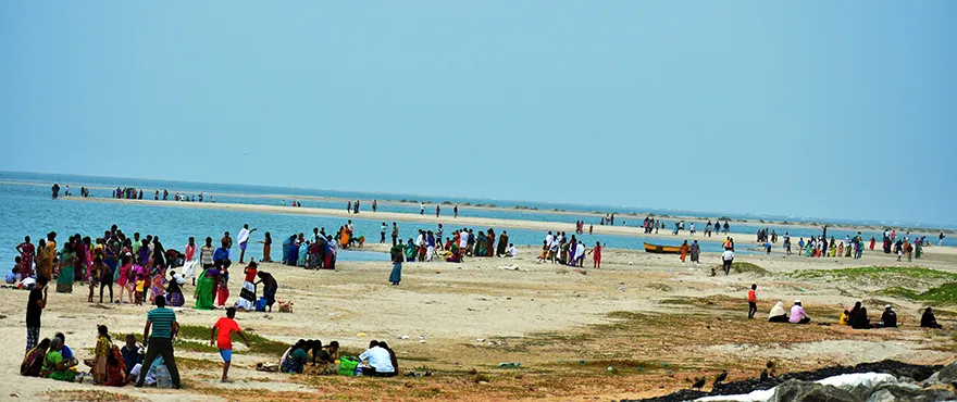
Nevertheless, a peaceful stroll or a bike ride along the beach delivers an unforgettable and exhilarating experience for visitors.
Rama Sethu or Arichal Munai View Point
Arichal Munai marks the exact point where the Indian Ocean meets the Bay of Bengal, and visitors can clearly view this natural confluence at Dhanushkodi.
According to legend, this is the sacred spot where Lord Rama pointed the end of his bow and commanded his army to build a bridge across the sea to Lanka (Sri Lanka) to rescue Goddess Sita. Therefore, this location holds immense mythological importance.
The southernmost end of Rameswaram and the meeting point of the two seas are collectively identified as Arichal Munai or Rama Sethu.
How to Reach Dhanushkodi
To facilitate tourism, the Government of India introduced public transportation services to Dhanushkodi. Visitors can reach the destination using government buses, auto-rickshaws, or private vehicles such as bikes, cars, and vans.
Dhanushkodi is situated approximately 26 kilometres from the Rameswaram bus stand and about 24 kilometres from the railway station. Moreover, Rameswaram connects well with major cities through road and rail networks. For air travel, the nearest airport is located at Madurai, nearly 198 kilometres away.
Epilogue
Ultimately, the haunting beauty of Dhanushkodi leaves a lasting impression on every visitor. The expansive beach, roaring tides, crystal-clear blue waters, and haunting ruins of the once-thriving town together evoke a deep sense of wonder and reflection.
Dhanushkodi – FAQ
Why is Dhanushkodi called a ghost town?
Dhanushkodi is called a ghost town because it was destroyed by a powerful cyclone in 1964. After the disaster, the town was declared unfit for habitation, leaving behind haunting ruins.
Where is Dhanushkodi located?
Dhanushkodi is located at the southeastern tip of Rameswaram Island in Ramanathapuram district, Tamil Nadu, where the Bay of Bengal meets the Indian Ocean.
What are the main attractions in Dhanushkodi?
Key attractions include the abandoned church ruins, old railway station remains, Arichal Munai (land’s end), and the serene beach views.
Is Dhanushkodi connected to the Ramayana?
Yes, according to legend, Lord Rama marked the spot here with his bow (Dhanush) before the construction of Rama Setu to Lanka, giving the town its name.
What is the best time to visit Dhanushkodi?
The best time to visit is from October to March when the weather is pleasant and ideal for sightseeing.
Tourist Attractions near Dhanushkodi:
- Ramanathaswamy Temple, Rameswaram
- Agni Theertham Beach
- APJ Abdul Kalam Memorial – Rameswaram
- Kunthukal Beach
- Pamban Bridge